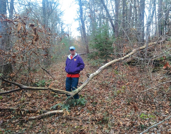
The vanishing remains of the first road across the Plateau
Published 4:49 pm Tuesday, November 30, 2021
|
Getting your Trinity Audio player ready...
|
By Bill Carey
Tennessee likes to boast about old structures it has preserved and historical markers it has erected. However, in terms of remembering migration routes, our state could do a much better job.
The first road across the Cumberland Plateau connected Kingston (on the east side of the plateau) to a nineteenth century fortress called Fort Blount (on the west side of the plateau). This road was taken by thousands of early migrants in the 1780s and 1790s, some of whose journeys are documented in personal journals.
Among the better known of these early migrants were Andrew Jackson, Bishop Francis Asbury and the French botanist Andre Michaux. However, the most remarkable of these travelers was a French nobleman who traveled through Tennessee during the French Revolution under the title Louis Philippe, Duke of Orleans. The nephew of Louis XVI, Louis Philippe, later became the king of France from 1830 to 1848.
Today, some people refer to this early road as the Avery Trace or the Holston Road, although it went by many names. I call it the Fort Blount Road.
Around 1795, a new branch of the Fort Blount Road was created that took westward migrants a more direct route into Middle Tennessee. This branch was created by William Walton, and the community he started at the westward end of the road is known as Carthage.
No one has done more to learn about the history of the roads than the late Tennessee Tech history professor Calvin Dickinson, who published The Walton Road: A Nineteenth Century Wilderness Highway in Tennessee in 2007. Dickinson died a few months ago, but I’m happy to say that back in 2019, he and I went searching for remnants of the road.
Leaving Kingston, the old road climbed to the top of the Cumberland Plateau using the general route of Highway 70. In the late 1700s, migrants had a terrible time ascending the 1,000-foot climb here; some would carry their possessions one at a time from the bottom to the top rather than risk taking them up all at once. As we ascended the mountain along this highway, Calvin and I thought we saw the old roadbed going off into the woods at times, but we couldn’t be sure.
Moving westward, the old road passed by the scenic landmark known as Ozone Falls and into a low point between two mountains near the community of Crab Orchard. On April 1, 1794, Thomas “Big Foot” Spencer was killed near here, which is why a monolith that towers over the valley here was named for him. Later, a prominent inn at Crab Orchard provided a stopover point for travelers.
About ten miles west of Spencer’s Rock, the state has erected a sign at an I-40 rest area that documents the site of Kemmer Tavern, an inn located on the old road. Calvin and I explored this rest stop and easily found the remnants of the old roadbed, although I’ll admit that we crossed a barbed wire fence in the process.
Moving west, the old roadbed meanders back and forth along present-day Interstate 40 and Highway 70. We drove down a few country roads and into residential areas and Dickinson pointed out a couple of places where he knew the roadbed to be from his earlier research. Most of the time I had to admit that I never would have noticed them.
In the 1780s and 1790s, just about every traveler along the old road stopped at a place called Flat Rock, which is east of Monterey. Unfortunately, Flat Rock is now on private property.
As the old road approached Cookeville, it passed by an old homestead called White Plains, which still stands. The old road then went right through present-day Cookeville, missing the Tennessee Tech campus to the north.
Descending west from Cookeville in the direction of Carthage, the roadbed follows the general route of Highway 70. A DAR marker highlights the location of Raulston Stand, a landmark on the Walton Road whose visitors included Andrew Jackson, James K. Polk and Andrew Johnson.
What did I conclude from my unforgettable day with Dr. Dickinson?
The Volunteer State should do a better job of documenting and preserving the places and the trails that guided our migrating ancestors. With some effort, the Fort Blount and Walton Roads could be turned into historical tourist attractions, like the Natchez Trace or Oregon Trail.


